Hyppää pääsisältöön
MTV Katsomo
  • MTV UutisetKonepajankuja 7
    00510 Helsinki
  • Uutistoimituksen päivystys010 300 5400
  • Uutisvinkkiuutiset@mtv.fi
  • WhatsApp040 578 5504
Sisällöt
  • Tomi Einonen
    Vastaava päätoimittaja
  • Ilkka Ahtiainen
    Uutispäätoimittaja
  • Mona Haapsaari
    Julkaisupäällikkö
  • Teemu Niikko
    Toimituspäällikkö, urheilu
Liiketoiminta ja kehitys
  • Jaakko Hietanen
    Head of Digital Development
Muut palvelut
  • MTV Katsomo
  • Makuja
Asiakaspalvelu
  • MTV Uutiset -palaute
  • MTV Katsomon asiakaspalvelu
  • MTV Uutisten periaatelinja
  • MTV Uutiset ja tekoäly
MTV Uutiset on sitoutunut noudattamaan Journalistin ohjeita
  • Julkisen sanan neuvosto (JSN)
  • Tietoa yhtiöstä
  • Avoimet työpaikat
  • Mainosta MTV:ssä
  • Tietosuojalauseke
  • Käyttöehdot
EtusivuVideotTuoreimmatLuetuimmatOdota
Hyppää pääsisältöön
MTV Katsomo
Hyppää pääsisältöön
MTV Katsomo
mtv katsomo
TuoreimmatSääLiigaJääkiekon MM-kisatEuroviisut - Linda ja PeteAsian ytimessäRikosPörssisähkön hinta juuri nyt
Uutiset
KotimaaUlkomaatRikosPolitiikkaTalousMielipiteetSääPörssisähkön hinta juuri nyt
Urheilu
LiigaMM-ralliOlympialaisetJääkiekon MM-kisatJääkiekkoF1JalkapalloYleisurheilu
Viihde
SeurapiiritTV-ohjelmatElokuvatKuninkaallisetMusiikkiSalatut elämät
Lifestyle
RuokaTerveys ja hyvinvointiSeksi ja parisuhdeAutotHoroskooppi
Makuja
ReseptitRuokauutiset
Videot
MTV Uutiset LiveUusimmat
Tv-opas
Muistilista
Asetukset
Uutiset
Sää
  • Helsinki
  • Espoo
  • Tampere
  • Vantaa
  • Turku

Sääuutiset

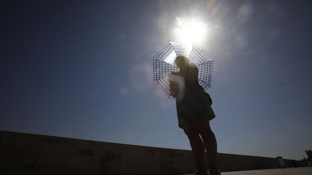
Pekka Pouta: Suomessa kohta lämpimämpää kuin Euroopan hellealueilla

Pekka Pouta: Suomessa kohta lämpimämpää kuin Euroopan hellealueilla

Eurooppa
Helleaallot aikaistuvat ja yleistyvät – näin muutos iskee Suomessa ja maailmalla

Helleaallot aikaistuvat ja yleistyvät – näin muutos iskee Suomessa ja maailmalla

Ilmastonmuutos
Täällä valmistuvia hellitään lämmöllä

Täällä valmistuvia hellitään lämmöllä

Kotimaa
Nyt tuli synkkä ennuste: super-El Niño voi räjäyttää ensi vuonna lämpöennätykset

Nyt tuli synkkä ennuste: super-El Niño voi räjäyttää ensi vuonna lämpöennätykset

Ilmastonmuutos
Pekka Pouta: Helteet ja ukkoset saapuvat!

Pekka Pouta: Helteet ja ukkoset saapuvat!

Kesä
Poikkeuksellinen helle piinaa Eurooppaa: "Emme voi elää näin"

Poikkeuksellinen helle piinaa Eurooppaa: "Emme voi elää näin"

Helle
Kesäkuun ennuste julki – tältä näyttää juhannusviikon sää

Kesäkuun ennuste julki – tältä näyttää juhannusviikon sää

Kesä
Muhiva käänne: Mombasa-sää

Muhiva käänne: Mombasa-sää

Markus Mäntykannas

Suomen suurimpien kaupunkien sää:

  • Helsinki
  • Tampere
  • Turku
  • Oulu
  • Espoo
  • Jyväskylä
  • Vantaa
  • Lahti
  • Kuopio
  • Pori

Lisää aiheesta

Sää

Luetuimmat

  • 1.
    Eurooppa

    Pekka Pouta: Suomessa kohta lämpimämpää kuin Euroopan hellealueilla

    10:38
  • 2.
    Rattijuopumus

    HS: Poliisi ei epäile ratista kärynnyttä kansanedustajaa sakkovilpistä

    11:27
  • 3.
    Kotimaa

    Sinimusta liike julkaisi syrjivän vaaliohjelmansa – Helsingin keskustassa rähinä

    13:56
  • 4.
    Eino Grön

    Eino Grön teki paljastuksen Spedestä – erikoinen tyyli golfkentällä

    11:38
  • 5.
    MM-ralli

    Sébastien Ogier tylyttää Toyota-tallikaveria: "Ei yllätys" – Jari-Matti Latvalalta suoraa tekstiä perään

    13:09
  • Helle tappaa Ranskassa – toukokuun lämpöennätys meni rikki
    Ranska

    Helle tappaa Ranskassa – toukokuun lämpöennätys meni rikki

    ti 14:22
  • Euroopassa lähes +40, Suomessa paikoin +5 ja ukkosia: Katso meteorologin selitys
    Ukkonen

    Euroopassa lähes +40, Suomessa paikoin +5 ja ukkosia: Katso meteorologin selitys

    ti 10:12
  • 34,8 astetta! Britanniassa ennätyslämmintä
    Iso-Britannia

    34,8 astetta! Britanniassa ennätyslämmintä

    ma 19:39
  • Pekka Pouta: Ilouutinen lakkiaisviikonlopulle – "Kuin tilaustyötä"
    Kesä

    Pekka Pouta: Ilouutinen lakkiaisviikonlopulle – "Kuin tilaustyötä"

    ma 09:30
  • Äkkiä uimaan! Järvet ovat lämmenneet mukavasti – takapakki kuitenkin uhkaa
    Markus Mäntykannas

    Äkkiä uimaan! Järvet ovat lämmenneet mukavasti – takapakki kuitenkin uhkaa

    24.5. 15:24
  • Kylmä kupla sulkee Suomen syleilyynsä – odotettu käänne jo näköpiirissä: "Viikko kärvistellään"
    Kevät

    Kylmä kupla sulkee Suomen syleilyynsä – odotettu käänne jo näköpiirissä: "Viikko kärvistellään"

    24.5. 11:55
Sää San Narciso, Filippiinit | Säätiedot ja Sadetutka | MTV Uutiset
Lauantai 30.5. Aurinko paistaa

Uusin säälähetys:

Huomenta Suomen sää

Sää: San Narciso, San Narciso, Filippiinit

la 30. toukokuuta 2026
29 °CTuntuu kuin 37 °C
2 m/s66 %
heikkoa sadetta
5:2818:25
19:00
29 °C1.3 mm2 m/s
20:00
30 °C0.2 mm1 m/s
21:00
29 °C0 mm2 m/s
22:00
29 °C0.2 mm2 m/s
23:00
28 °C0 mm2 m/s
0:00
28 °C0 mm1 m/s
1:00
28 °C0 mm2 m/s
2:00
28 °C0 mm1 m/s
3:00
28 °C0 mm1 m/s
4:00
27 °C0 mm2 m/s
5:00
27 °C0 mm1 m/s
6:00
27 °C0 mm1 m/s
7:00
29 °C0 mm1 m/s
8:00
31 °C0 mm1 m/s
9:00
32 °C0 mm3 m/s
10:00
32 °C0.1 mm3 m/s
11:00
32 °C0.1 mm4 m/s
12:00
32 °C0 mm6 m/s
13:00
32 °C0 mm5 m/s
14:00
32 °C0 mm4 m/s
15:00
32 °C0.3 mm4 m/s
16:00
32 °C0.2 mm3 m/s
17:00
31 °C0.1 mm3 m/s
18:00
29 °C0.6 mm2 m/s
Tropical Cyclone Alert : Severe Tropical Storm Domeng (JANGMI) “DOMENG” SLIGHTLY INTENSIFIES WHILE MOVING NORTHWESTWARD OVER THE PHILIPPINE SEA EAST OF NORTHERN LUZON. Location of eye/center : The center of Severe Tropical Storm DOMENG was estimated based on all available data at at 875 km East of Northern Luzon (17.7, 130.0). Strength : Maximum winds of 100 kph near the centerand gustiness of up to 125 kph. Forecast movement : Forecast to move Northwestward at 20 kph Forecast position : May 31, 2026 02:00 AM - 675 km East of Basco, Batanes May 31, 2026 02:00 PM - 625 km East Northeast of Basco, Batanes Jun 01, 2026 02:00 AM - 645 km East Northeast of Itbayat, Batanes Jun 01, 2026 02:00 PM - 750 km Northeast of Itbayat, Batanes (OUTSIDE PAR) Jun 02, 2026 02:00 AM - 990 km Northeast of Extreme Northern Luzon (OUTSIDE PAR) HAZARDS AFFECTING LAND AREAS Heavy Rainfall Outlook Refer to Weather Advisory No. 2 issued at 11:00 AM today for the heavy rainfall outlook due to the enhanced Southwest Monsoon. Severe Winds Based on the latest forecast track, the hoisting of tropical cyclone wind signal over Extreme Northern Luzon is less likely, but not ruled out. The enhancement of the Southwest Monsoon and the periphery of DOMENG will bring strong to gale-force gusts over the following areas (especially in coastal and upland areas exposed to winds): Today: Most of Visayas, Batanes, Cagayan, Pangasinan, Zambales, Bataan, Tarlac, Nueva Ecija, Bulacan, CALABARZON, MIMAROPA, Bicol Region, Zamboanga del Norte, Misamis Oriental, Camiguin, Agusan del Norte, Surigao del Norte, Dinagat Islands, Sarangani, Davao Occidental, and Davao Oriental. Tomorrow (31 May): Most of Visayas, Batanes, Cagayan, CALABARZON, MIMAROPA, Bicol Region, Zamboanga del Norte, Misamis Occidental, Misamis Oriental, Camiguin, Agusan del Norte, Dinagat Islands, Surigao del Norte, Sarangani, Davao Occidental, and Davao Oriental. Monday (01 June): Most of Visayas, Batanes, Babuyan Islands, CALABARZON, MIMAROPA, Bicol Region, Camiguin, Dinagat Islands, Davao Occidental, and Davao Oriental. HAZARDS AFFECTING COASTAL WATERS 24-Hour Sea Condition Outlook Up to rough seas over the following coastal waters: Up to 3.5 m: The eastern seaboard of Batanes and Babuyan Islands. Up to 3.0 m: The remaining seaboards of Batanes; the northern seaboard of Babuyan Islands; the eastern seaboard of Cagayan, Isabela, and northern portion of Aurora. Mariners of small seacrafts, including all types of motorbancas, are advised not to venture out to sea under these conditions, especially if inexperienced of operating ill-equipped vessels. Up to moderate seas over the following coastal waters: Up to 2.5 m: The remaining seaboards of Babuyan Islands, Cagayan, and Aurora; the northern and eastern seaboards of Polillo Islands, Catanduanes, and Northern Samar; the eastern seaboards of northern Quezon and Eastern Samar; the northern seaboards of Camarines Norte and Camarines Sur. Up to 2.0 m: The seaboards of Ilocos Norte, Southern Leyte, Surigao del Norte, and Dinagat Islands; the eastern seaboard of Davao Occidental; the southern seaboard of Bohol; the northern seaboard of Camiguin; the eastern and southern seaboards of Davao Oriental. Mariners of motorbancas and similarly sized vessels are advised to take precautionary measures while venturing out to sea and, if possible, avoid navigation under these conditions. Other coastal waters have forecast wave heights of less than 2.0 m. TRACK AND INTENSITY OUTLOOK It must be emphasized that heavy rainfall and severe winds may still be experienced in localities outside the forecast confidence cone. Refer to “Other Hazards affecting Land Areas” for more details. Furthermore, the track may still shift within the limit of the forecast confidence cone. Severe Tropical Storm DOMENG is forecast to move generally northwestward until tomorrow (31 May) before recurving towards southern Japan for the remaining forecast period. This tropical cyclone is less likely to make landfall over the country. DOMENG will likely exit the Philippine Area of Responsibility (PAR) by Monday (01 June). DOMENG will continue to intensify and may reach typhoon category tonight or tomorrow morning while remaining over the Philippine Sea. Afterwards, it will steadily weaken but will remain as a typhoon throughout the rest of the forecast period.
Varoitus voimassa la klo 11:32 - la klo 19:39
Tropical Cyclone Alert : Severe Tropical Storm Domeng (JANGMI) “DOMENG” SLIGHTLY INTENSIFIES WHILE MOVING NORTHWESTWARD OVER THE PHILIPPINE SEA EAST OF NORTHERN LUZON. Location of eye/center : The center of Severe Tropical Storm DOMENG was estimated based on all available data at at 875 km East of Northern Luzon (17.7, 130.0). Strength : Maximum winds of 100 kph near the centerand gustiness of up to 125 kph. Forecast movement : Forecast to move Northwestward at 20 kph Forecast position : May 30, 2026 08:00 PM - 735 km East Southeast of Basco, Batanes May 31, 2026 08:00 AM - 630 km East of Basco, Batanes May 31, 2026 08:00 PM - 610 km East Northeast of Itbayat, Batanes Jun 01, 2026 08:00 AM - 655 km Northeast of Itbayat, Batanes Jun 01, 2026 08:00 PM - 820 km Northeast of Extreme Northern Luzon (OUTSIDE PAR) Jun 02, 2026 08:00 AM - 1,080 km Northeast of Extreme Northern Luzon (OUTSIDE PAR) HAZARDS AFFECTING LAND AREAS Heavy Rainfall Outlook Refer to Weather Advisory No. 2 issued at 11:00 AM today for the heavy rainfall outlook due to the enhanced Southwest Monsoon. Severe Winds Based on the latest forecast track, the hoisting of tropical cyclone wind signal over Extreme Northern Luzon is less likely, but not ruled out. The enhancement of the Southwest Monsoon and the periphery of DOMENG will bring strong to gale-force gusts over the following areas (especially in coastal and upland areas exposed to winds): Tomorrow (30 May): Most of Visayas, Batanes, Cagayan, Pangasinan, Zambales, Bataan, Tarlac, Nueva Ecija, Bulacan, CALABARZON, MIMAROPA, Bicol Region, Zamboanga del Norte, Misamis Oriental, Camiguin, Agusan del Norte, Surigao del Norte, Dinagat Islands, Sarangani, Davao Occidental, and Davao Oriental. Sunday (31 May): Most of Visayas, Batanes, Cagayan, CALABARZON, MIMAROPA, Bicol Region, Zamboanga del Norte, Misamis Occidental, Misamis Oriental, Camiguin, Agusan del Norte, Dinagat Islands, Surigao del Norte, Sarangani, Davao Occidental, and Davao Oriental. Monday (01 June): Most of Visayas, Batanes, Babuyan Islands, CALABARZON, MIMAROPA, Bicol Region, Camiguin, Dinagat Islands, Davao Occidental, and Davao Oriental. HAZARDS AFFECTING COASTAL WATERS 24-Hour Sea Condition Outlook Up to rough seas over the following coastal waters: Up to 3.5 m: The eastern seaboard of Batanes and Babuyan Islands. Up to 3.0 m: The remaining seaboards of Batanes; the northern seaboard of Babuyan Islands; the eastern seaboard of Cagayan, Isabela, and northern portion of Aurora. Mariners of small seacrafts, including all types of motorbancas, are advised not to venture out to sea under these conditions, especially if inexperienced of operating ill-equipped vessels. Up to moderate seas over the following coastal waters: Up to 2.5 m: The remaining seaboards of Babuyan Islands, Cagayan, and Aurora; the northern and eastern seaboards of Polillo Islands, Catanduanes, and Northern Samar; the eastern seaboards of northern Quezon and Eastern Samar; the northern seaboards of Camarines Norte and Camarines Sur. Up to 2.0 m: The seaboards of Ilocos Norte, Southern Leyte, Surigao del Norte, and Dinagat Islands; the eastern seaboard of Davao Occidental; the southern seaboard of Bohol; the northern seaboard of Camiguin; the eastern and southern seaboards of Davao Oriental. Mariners of motorbancas and similarly sized vessels are advised to take precautionary measures while venturing out to sea and, if possible, avoid navigation under these conditions. Other coastal waters have forecast wave heights of less than 2.0 m. TRACK AND INTENSITY OUTLOOK It must be emphasized that heavy rainfall and severe winds may still be experienced in localities outside the forecast confidence cone. Refer to “Other Hazards affecting Land Areas” for more details. Furthermore, the track may still shift within the limit of the forecast confidence cone. Severe Tropical Storm DOMENG is forecast to move generally northwestward until tomorrow (31 May) before recurving towards southern Japan for the remaining forecast period. This tropical cyclone is less likely to make landfall over the country. DOMENG will likely exit the Philippine Area of Responsibility (PAR) by Monday (01 June). DOMENG will continue to intensify and may reach typhoon category tonight or tomorrow morning while remaining over the Philippine Sea. Afterwards, it will steadily weaken but will remain as a typhoon throughout the rest of the forecast period.
Varoitus voimassa la klo 5:32 - la klo 18:31

San Narciso 7 vrk säätiedot tunneittain

Sataako vai paistaako lähipäivinä? Alla löydät 7 vrk säätiedot tunnin tarkkuudella. Valitse kuntasi tai alueesi ylhäältä ja kokeile!

0:00
28 °C
0 mm1 m/s
1:00
28 °C
2 m/s
2:00
28 °C
1 m/s
3:00
28 °C
1 m/s
4:00
27 °C
2 m/s
5:00
27 °C
1 m/s
6:00
27 °C
1 m/s
7:00
29 °C
1 m/s
8:00
31 °C
1 m/s
9:00
32 °C
0 mm3 m/s
10:00
32 °C
0.1 mm3 m/s
11:00
32 °C
0.1 mm4 m/s
12:00
32 °C
0 mm6 m/s
13:00
32 °C
0 mm5 m/s
14:00
32 °C
0 mm4 m/s
15:00
32 °C
0.3 mm4 m/s
16:00
32 °C
0.2 mm3 m/s
17:00
31 °C
0.1 mm3 m/s
18:00
29 °C
0.6 mm2 m/s
19:00
29 °C
0.4 mm1 m/s
20:00
29 °C
0.2 mm0 m/s
21:00
28 °C
0.1 mm0 m/s
22:00
28 °C
0 mm1 m/s
23:00
27 °C
2 m/s
0:00
27 °C
0 mm2 m/s
1:00
27 °C
0 mm1 m/s
2:00
27 °C
0.1 mm1 m/s
3:00
27 °C
0.2 mm2 m/s
4:00
26 °C
0.1 mm2 m/s
5:00
26 °C
0.1 mm1 m/s
6:00
27 °C
0.2 mm1 m/s
7:00
28 °C
0.4 mm2 m/s
8:00
30 °C
0.2 mm2 m/s
9:00
31 °C
0.1 mm2 m/s
10:00
32 °C
0.2 mm2 m/s
11:00
32 °C
0.3 mm3 m/s
12:00
31 °C
0.3 mm5 m/s
13:00
30 °C
2.4 mm3 m/s
14:00
30 °C
0.2 mm3 m/s
15:00
31 °C
0.1 mm3 m/s
16:00
30 °C
0 mm2 m/s
17:00
29 °C
0.1 mm3 m/s
18:00
28 °C
1.3 mm2 m/s
19:00
28 °C
0.5 mm1 m/s
20:00
28 °C
0.3 mm2 m/s
21:00
27 °C
0 mm2 m/s
22:00
27 °C
0 mm2 m/s
23:00
26 °C
2 m/s
0:00
27 °C
0 mm1 m/s
1:00
27 °C
1.8 mm2 m/s
2:00
27 °C
0.5 mm2 m/s
3:00
27 °C
0.2 mm2 m/s
4:00
26 °C
0 mm3 m/s
5:00
26 °C
0 mm3 m/s
6:00
26 °C
0 mm3 m/s
7:00
27 °C
3 m/s
8:00
29 °C
0 mm3 m/s
9:00
31 °C
0.2 mm4 m/s
10:00
29 °C
2.5 mm6 m/s
11:00
30 °C
7.1 mm2 m/s
12:00
31 °C
1.4 mm4 m/s
13:00
30 °C
2.5 mm4 m/s
14:00
29 °C
4.8 mm3 m/s
15:00
29 °C
1.6 mm2 m/s
16:00
29 °C
0.6 mm3 m/s
17:00
27 °C
4.6 mm4 m/s
18:00
28 °C
1.5 mm1 m/s
19:00
28 °C
1.1 mm2 m/s
20:00
28 °C
0.3 mm1 m/s
21:00
27 °C
0.1 mm2 m/s
22:00
27 °C
0.1 mm1 m/s
23:00
26 °C
4.4 mm2 m/s
0:00
26 °C
3.3 mm2 m/s
1:00
27 °C
4 mm1 m/s
2:00
27 °C
0.9 mm2 m/s
3:00
26 °C
1.1 mm2 m/s
4:00
26 °C
1.1 mm1 m/s
5:00
26 °C
1.1 mm1 m/s
6:00
26 °C
2.3 mm2 m/s
7:00
27 °C
2.3 mm3 m/s
8:00
28 °C
2.3 mm4 m/s
9:00
28 °C
3.6 mm4 m/s
10:00
29 °C
3.6 mm4 m/s
11:00
30 °C
3.6 mm4 m/s
12:00
29 °C
2.2 mm5 m/s
13:00
29 °C
2.2 mm5 m/s
14:00
29 °C
2.2 mm6 m/s
15:00
28 °C
2.6 mm5 m/s
16:00
28 °C
2.6 mm4 m/s
17:00
28 °C
2.6 mm3 m/s
18:00
27 °C
2.8 mm3 m/s
19:00
27 °C
2.8 mm4 m/s
20:00
27 °C
2.8 mm4 m/s
21:00
27 °C
2.4 mm4 m/s
22:00
27 °C
2.4 mm5 m/s
23:00
27 °C
2.4 mm6 m/s
0:00
27 °C
3.2 mm5 m/s
1:00
27 °C
3.2 mm4 m/s
2:00
27 °C
3.2 mm3 m/s
3:00
27 °C
3.3 mm4 m/s
4:00
26 °C
3.3 mm4 m/s
5:00
26 °C
3.3 mm5 m/s
6:00
26 °C
3.5 mm4 m/s
7:00
27 °C
3.5 mm4 m/s
8:00
27 °C
3.5 mm4 m/s
9:00
28 °C
3.2 mm5 m/s
10:00
28 °C
3.2 mm6 m/s
11:00
29 °C
3.2 mm6 m/s
12:00
29 °C
3.4 mm6 m/s
13:00
29 °C
3.4 mm6 m/s
14:00
29 °C
3.4 mm5 m/s
15:00
29 °C
2.5 mm5 m/s
16:00
28 °C
2.5 mm5 m/s
17:00
28 °C
2.5 mm5 m/s
18:00
28 °C
3.2 mm5 m/s
19:00
28 °C
3.2 mm5 m/s
20:00
28 °C
3.2 mm5 m/s
21:00
27 °C
2.9 mm5 m/s
22:00
27 °C
2.9 mm4 m/s
23:00
27 °C
2.9 mm4 m/s
0:00
27 °C
2.9 mm5 m/s
1:00
27 °C
2.9 mm5 m/s
2:00
27 °C
2.9 mm5 m/s
3:00
27 °C
2.2 mm5 m/s
4:00
27 °C
2.2 mm5 m/s
5:00
26 °C
2.2 mm5 m/s
6:00
26 °C
2.2 mm5 m/s
7:00
26 °C
2.2 mm4 m/s
8:00
26 °C
2.2 mm4 m/s
9:00
27 °C
2.6 mm4 m/s
10:00
27 °C
2.6 mm4 m/s
11:00
28 °C
2.6 mm4 m/s
12:00
28 °C
2.6 mm4 m/s
13:00
27 °C
2.6 mm4 m/s
14:00
27 °C
2.6 mm4 m/s
15:00
27 °C
2.8 mm4 m/s
16:00
27 °C
2.8 mm4 m/s
17:00
27 °C
2.8 mm4 m/s
18:00
27 °C
2.8 mm3 m/s
19:00
26 °C
2.8 mm3 m/s
20:00
26 °C
2.8 mm3 m/s
21:00
26 °C
2.4 mm3 m/s
22:00
26 °C
2.4 mm3 m/s
23:00
26 °C
2.4 mm3 m/s
0:00
26 °C
2.4 mm3 m/s
1:00
26 °C
2.4 mm3 m/s
2:00
26 °C
2.4 mm3 m/s
3:00
25 °C
2 mm3 m/s
4:00
25 °C
2 mm3 m/s
5:00
25 °C
2 mm3 m/s
6:00
26 °C
2 mm3 m/s
7:00
26 °C
2 mm3 m/s
8:00
27 °C
2 mm3 m/s
9:00
27 °C
2.5 mm3 m/s
10:00
28 °C
2.5 mm3 m/s
11:00
28 °C
2.5 mm3 m/s
12:00
28 °C
2.5 mm3 m/s
13:00
28 °C
2.5 mm3 m/s
14:00
28 °C
2.5 mm3 m/s
15:00
27 °C
2.2 mm3 m/s
16:00
27 °C
2.2 mm3 m/s
17:00
27 °C
2.2 mm3 m/s
18:00
27 °C
2.2 mm3 m/s